Thank YOU! It's Customer Appreciation Week!
EXTRA 11% OFF Orders $100+ With Code: THANKYOU
EXTRA 11% OFF Orders $100+ With Code: THANKYOU

 Give a Cheer
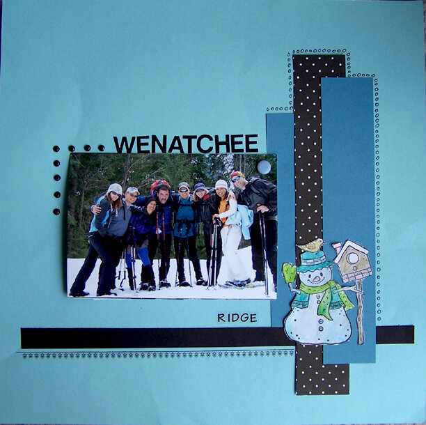
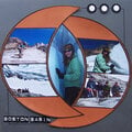
Based on Q-Diggity's sketch. There are 3 more photos and journaling hiden behind the first pic and the journaling reads:
When I first planned the trip, the forecast was for rain on west side of the mountains but sunshine over the pass. When I checked the forecast the night before hike, I was not so optimistic anymore. The chances of rain increased to 70 % at the area we were going to.
Fortunately this proved to be completely wrong. We encountered little bit of slush and clouds while driving over the pass but soon after we got to the east side of the mountains, the sun was out and shining bright. At that point I knew we'll be OK.
The first two miles lead on a snowed in road. The first two miles seemed never ending. Then we finally got to an intersection with a sign pointing to the viewpoint we were aiming for, stating we had 4 more miles to go. We followed FS Roads all the way up, making route finding non existent, and snowshoes not needed. There was not too much snow left and it was packed quite solid. Few people decided to put their snowshoes on just for the heck of it but most of us comfortably booted it up.
To make the trip more adventurous we cut few switchbacks on the way down. It did not prove to be the best idea since we got to a point where we needed to traverse a steeper slope and few members of our expedition were not comfortable in a terrain we got into. I mean it was nothing comparing to things we do other times but I can see that for people who are not use to steeper areas, it could to quite intimidating. So we found a different route that was acceptable for the whole group and made it safely down to the FS Road.
It was a great learning experience and decision was made that we won't be going off trail on future outings if we don't know exactly what type of terrain we can encounter.
No products have been added to this project.


Thanks for spreading positivity!


May 05, 2008
April 24, 2008
April 24, 2008
April 22, 2008
April 19, 2008
April 19, 2008
April 18, 2008
April 15, 2008
April 11, 2008
April 11, 2008
April 11, 2008
April 11, 2008
April 10, 2008
April 10, 2008
April 10, 2008
April 10, 2008
April 10, 2008
April 10, 2008
April 10, 2008
April 09, 2008
April 09, 2008
April 09, 2008
April 09, 2008
April 09, 2008
April 09, 2008
April 09, 2008